Ditapis dengan

International Navigation Congress Section I
- Edisi
- -
- ISBN/ISSN
- -
- Deskripsi Fisik
- -
- Judul Seri
- -
- No. Panggil
- SCX TXT INT p
- Edisi
- -
- ISBN/ISSN
- -
- Deskripsi Fisik
- -
- Judul Seri
- -
- No. Panggil
- SCX TXT INT p

International Navigation Congress Section II
- Edisi
- -
- ISBN/ISSN
- -
- Deskripsi Fisik
- -
- Judul Seri
- -
- No. Panggil
- SCX TXT INT p
- Edisi
- -
- ISBN/ISSN
- -
- Deskripsi Fisik
- -
- Judul Seri
- -
- No. Panggil
- SCX TXT INT p

Permanent International Association of Navigation Congresses
- Edisi
- -
- ISBN/ISSN
- -
- Deskripsi Fisik
- -
- Judul Seri
- -
- No. Panggil
- SC TXT PER i
- Edisi
- -
- ISBN/ISSN
- -
- Deskripsi Fisik
- -
- Judul Seri
- -
- No. Panggil
- SC TXT PER i
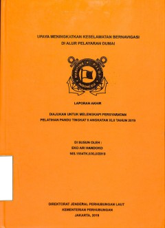
Upaya Meningkatkan Keselamatan Bernavigasi Di Alur Pelayaran Dumai
- Edisi
- Laporan Akhir Pelatihan Pandu tingkat II Angkatan
- ISBN/ISSN
- -
- Deskripsi Fisik
- 36 p
- Judul Seri
- Laporan Akhir Pelatihan Pandu tingkat II Angkatan XLII Tahun 2019
- No. Panggil
- IPC REP 2019 UPA e
- Edisi
- Laporan Akhir Pelatihan Pandu tingkat II Angkatan
- ISBN/ISSN
- -
- Deskripsi Fisik
- 36 p
- Judul Seri
- Laporan Akhir Pelatihan Pandu tingkat II Angkatan XLII Tahun 2019
- No. Panggil
- IPC REP 2019 UPA e
Long-term container throughput forecast and equipment planning: the case of B…
Abstract Purpose – This paper aims to forecast inbound and outbound container throughput for Bangkok Port to 2041 and uses the results to inform the future planning and management of the port’s container terminal. Design/methodology/approach – The data used cover a period of 16 years (192 months of observations). Data sources include the Bank of Thailand and the Energy Policy and Plannin…
- Edisi
- Maritime Business Review
- ISBN/ISSN
- -
- Deskripsi Fisik
- 18 halaman
- Judul Seri
- Long-term container throughput forecast and equipment planning: the case of Bangkok Port
- No. Panggil
- ATC PO VEE a
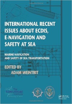
International recent issues about ecdis, e-navigation and safety at sea : mar…
The TransNav 2011 Symposium held at the Gdynia Maritime University, Poland in June 2011 has brought together a wide range of participants from all over the world. The program has offered a variety of contributions, allowing to look at many aspects of the navigational safety from various different points of view. Topics presented and discussed at the Symposium were: navigation, safety at …
- Edisi
- -
- ISBN/ISSN
- 978-0-415-69112-3
- Deskripsi Fisik
- 199 p, 21 cm
- Judul Seri
- -
- No. Panggil
- TXT MR WEI i
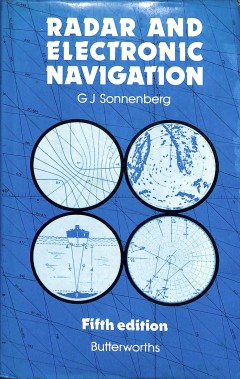
Radar and Electronic Navigation
The electronic aids available for marine navigation become more accurate and ambitious year by year. Indeed, development has been so rapid that, for its fiifth edition, this well-established and cmprehensive guide has been largely rewritten. The chapters on underwater navigational aids and the Decca and Loran system have been substantially revised, for example, and there are new chapters on the…
- Edisi
- 5
- ISBN/ISSN
- 0-4-8-00272-7
- Deskripsi Fisik
- 376 p., : illus : index : 22 cm
- Judul Seri
- -
- No. Panggil
- TXT MR SON r C.1
Analyzing the economic benefit of unmanned autonomous ships: An exploratory c…
Unmanned autonomous ships are seen as a key element of a competitive and sustainable European shipping industry in future. But even if the technology to further automate ships will principally be available at some point, this does not imply that autonomous vessels are also the superior choice for the ship owner. In the end the success of autonomous vessels depends on their impact on the profita…
- Edisi
- 2017
- ISBN/ISSN
- -
- Deskripsi Fisik
- 11 p.
- Judul Seri
- Research in Transportation Business & Management
- No. Panggil
- ATC LO KRE a

An analysis of ship escort and convoy operations in ice conditions
Winter navigation is a complex but common operation in the Northern Baltic Sea areas. In Finnish waters, the safety of the wintertime maritime transportation system is managed through the Finnish–Swedish winter navigation system. This system results in different operational modes of ship navigation, with vessels either navigating independently or under icebreaker assistance. A recent risk ana…
- Edisi
- 2016
- ISBN/ISSN
- 0925-7535
- Deskripsi Fisik
- 12p
- Judul Seri
- Safety Science
- No. Panggil
- ATC LO GOE a

Proposed Minimum Luminous Range for Existing Lighthouses in This Age of Globa…
Long-range visual marine aids to navigation are not required for current marine navigational practices. Therefore, the objective of this study was to develop a minimum luminous range for major lighthouses that are still in existence to sustain the operation of the lighthouses in the future. Two steps were involved in the determination of the minimum luminous range, namely the modification of th…
- Edisi
- -
- ISBN/ISSN
- -
- Deskripsi Fisik
- 8 p.
- Judul Seri
- ScienceDirect
- No. Panggil
- ATC PO UAD p
Navigation systems, equipment and aids
- Edisi
- Chapter 420
- ISBN/ISSN
- -
- Deskripsi Fisik
- xii, 52 p.
- Judul Seri
- -
- No. Panggil
- TXT MR DIR d
- Edisi
- Chapter 420
- ISBN/ISSN
- -
- Deskripsi Fisik
- xii, 52 p.
- Judul Seri
- -
- No. Panggil
- TXT MR DIR d

E-navigation services for Non-SOLAS ships
It is clearly understood that the main benefits of e-navigation are improved safety and better protection of the environment through the promotion of standards of navigational system and a reduction in human error. In order to meet the expectations on the benefit of e-navigation, enavigation services should be more focused on non-SOLAS ships. The purpose of this paper is to present necessary e-…
- Edisi
- -
- ISBN/ISSN
- -
- Deskripsi Fisik
- 10 p.
- Judul Seri
- -
- No. Panggil
- ATC MR KWA e

Improving Canada’s marine navigation system through e-navigation
The full application and benefits of e-Navigation, as a whole, cannot yet fully be known. Technological developments will continuously change the course of national and international initiatives in the field, and lead the pace of the evolution. However, how countries govern and support the development of e-Navigation is very much within the realm of control. National-level e-navigation governan…
- Edisi
- -
- ISBN/ISSN
- -
- Deskripsi Fisik
- 8 p.
- Judul Seri
- -
- No. Panggil
- ATC MR VAN e

Improving and assessing the impact of e-navigation applications
The scope of this paper is implementation issues of the e-Navigation concept of the International Maritime Organization (IMO). IMO has adopted the e-Navigation strategic implementation plan (SIP) in 2014. This plan, i.a., bases on estimating the effect of e-Navigation applications on reducing navigational accidents, including collisions and groundings of ships falling under the International Co…
- Edisi
- -
- ISBN/ISSN
- -
- Deskripsi Fisik
- 12 p .
- Judul Seri
- -
- No. Panggil
- ATC MR BAE i
A Guide to Ship Navigation Techniques
- Edisi
- -
- ISBN/ISSN
- -
- Deskripsi Fisik
- 37 p
- Judul Seri
- -
- No. Panggil
- TXT MR CHO a
- Edisi
- -
- ISBN/ISSN
- -
- Deskripsi Fisik
- 37 p
- Judul Seri
- -
- No. Panggil
- TXT MR CHO a

Pre-positioning commodities to repair maritime navigational aids
As the intensity of natural disasters increases, there is a need to develop policies and procedures to assist various agencies with moving aid to affected areas. One of the biggest limitations to this process is damage to transportation networks, in particular waterways. To keep waterways safe, aids to navigation (ATONs) are placed in various areas to guide mariners and ships to their final des…
- Edisi
- -
- ISBN/ISSN
- -
- Deskripsi Fisik
- 27 p.
- Judul Seri
- -
- No. Panggil
- ATC MR BEM p

The utilisation of pisang Island as a platform to support the current safety …
Current marine navigational practice relies less on long-range visual marine signals such as lighthouses for reference purposes. This is due to the availability of Global Navigation Satellite Systems (GNSS), which are integrated with other navigational aids on ships. Therefore, the objective of this study is to review the function of Pisang Island lighthouse and to propose the most relevant use…
- Edisi
- -
- ISBN/ISSN
- -
- Deskripsi Fisik
- 8 p.
- Judul Seri
- -
- No. Panggil
- ATC MR FAD t

A survey on the status of marine IT industrial environment for e-navigation S…
According to Software Quality Assurance (SQA) and the Human Centred Design (HCD) guidelines for e-navigation by Maritime Safety Committee of International Maritime Organization, software quality related activities and practices will be in demand in the maritime field. To provide high quality software and a usable system to users, e-navigation SQA is supported by Republic of Korea. After merging…
- Edisi
- -
- ISBN/ISSN
- -
- Deskripsi Fisik
- 13 p.
- Judul Seri
- -
- No. Panggil
- ATC MR KIM a

Advanced navigation aids system based on augmented reality
Many maritime accidents have been caused by human-error including such things as inadequate watch keeping and/or mistakes in ship handling. Also, new navigational equipment has been developed using Information Technology (IT) technology to provide various kinds of information for safe navigation. Despite these efforts, the reduction of maritime accidents has not occurred to the degree expected …
- Edisi
- -
- ISBN/ISSN
- -
- Deskripsi Fisik
- 11 p.
- Judul Seri
- -
- No. Panggil
- ATC MR OHJ a

Azimuth method for ship position in celestial navigation
The methods of celestial navigation to fix the ship position in line with the stars are only applied in the twilight time interval when both the celestial bodies and the horizon apppear simultaneously. This means that these methods cannot be used during the night even if the stars are visible. This paper proposes a novel approach which uses the azimuth of the celestial body in order to establi…
- Edisi
- -
- ISBN/ISSN
- -
- Deskripsi Fisik
- 8 p.
- Judul Seri
- -
- No. Panggil
- ATC MR NGU a

AIS data visualization for maritime spatial planning (MSP)
The constant increase in marine traffic and the simultaneous growth of the demand for exploiting marine areas (e.g., installing offshore wind power plants) require an adequate planning strategy for managing high traffic volumes. Maritime Spatial Planning (MSP) is the process of public development of an allocation plan for distributing, both spatially and temporally, human activities in marine a…
- Edisi
- -
- ISBN/ISSN
- -
- Deskripsi Fisik
- 16 p.
- Judul Seri
- -
- No. Panggil
- ATC MR FIO a
 Karya Umum
  Filsafat
  Agama
Agama  Ilmu-ilmu Sosial
  Bahasa
  Ilmu-ilmu Murni
  Ilmu-ilmu Terapan
  Kesenian, Hiburan, dan Olahraga
  Kesusastraan
  Geografi dan Sejarah